

Exhibit curated and designed by Katiana Bagué, under the supervision of Margarita Vargas-Betancourt.
Detail of Nova Hispania, Nova Galicia, Gvatimala Map. c. 1670- 1673. George A. Smathers Libraries, University of Florida
(Click on image to see the enlarged digital reproduction)
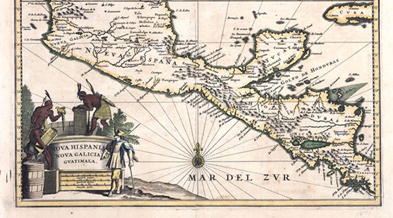
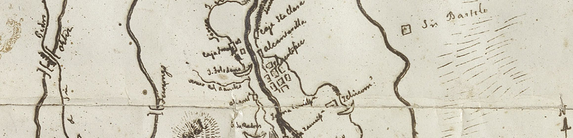
Alessandra Russo in her book The Untranslatable Image explains how maps and cartographic drawings were used by the Spaniards as a method to conquer and colonize the land during the sixteenth century. Moreover, as she explains, in order to attain or conquer a land, it is helpful to know its features and geography. In one of his accounts from his letters from 1526, Hernan Cortes describes a figura or map painting done by a tlacuilo or native painter. The painting was done on cloth and helped Cortes travel through the land. Maps thus became “strategic objects” for the Spaniards and many of them were sent to Spain along with other luxury items such as gems and feather works.