


Many antique maps of the Holy Land were more artistic imaginings than scientific renderings, with Jerusalem often placed at the center of the world. The maps shown here portray the Holy Land divided according to the twelve tribes of ancient Israel. These maps were usually created to accompany Bibles and biblical commentaries. In the case of Thomas Fuller’s A Pisgah Sight of Palestine the map accompanies his historical and geographical description of the Promised Land, which was written under forced exile during Oliver Cromwell’s rule. The illustrations in the Passover Haggadah from Amsterdam in 1695 were produced by Abraham ben Jacob, a convert to Judaism. It was the first haggadah to include a map, and clearly shows the influence of the Christian cartographers.
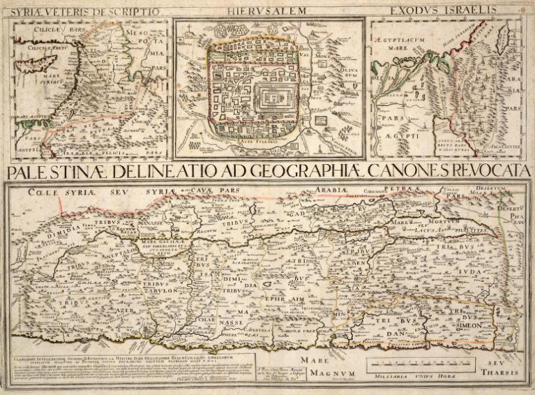
Palestinae delineatio ad geographiae canones revocata
From Parellela geographie veteris et novae
Paris
[1651]
Copper engraving
19.9 x 52.4 cm., on sheet 44.1 x 55.8 cm.
G7481.2 1651 .B7 CARTA
From the Map & Imagery Library, Holy Land Map Collection
Gift of Dr. James C. and Adina P. Simmons in memory of their parents
This map was originally published in a three volume historical atlas, Parellela geographie veteris et novae, 1641-1649 by the Jesuit Priest Philip Briet. The main title belongs to the largest section of the map. It shows a map of Palestine oriented with the East to the top and the land divided into the twelve tribes of Israel. The upper part of the map is divided into three sections, upper left showing Syria, upper middle showing Jerusalem, and the upper right depicting the exodus from Egypt.

Chorographia Terrae Sanctae in angustiorem formam redacta et ex variis auctoribus a multis erroribus expurgata
Antwerp
[1750]
Copper engraving
30.1 x 78.7 cm., on sheet 35.3 x 87.8 cm.
G7481.2 1750 .T5 CARTA
From the Map & Imagery Library,
Holy Land Map Collection
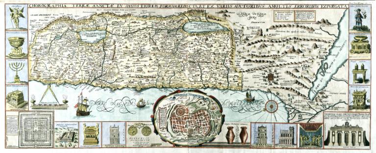
Extensive illustrations of biblical iconography and sacred places of Jerusalem decorate this map of Terrae Sanctae (Holy Lands). In addition to the lower middle inset of the city of Jerusalem in ancient times, the map also includes a diagram of Solomon’s Temple in the lower left and an artist’s perspective drawing in the lower right.
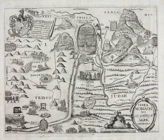
Terra Moriath sive Solymarvm ager suburbanus
From Thomas Fuller, A Pisgah-sight of Palestine
[London, 1650]
Copper engraving
28 x 33 cm., on sheet 33 x 40 cm.
G7481.2 1650.M3 CARTA
From the Map & Imagery Library, Holy Land Map Collection