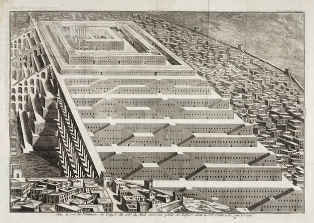
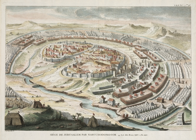
The maps presented here are focused on the Jewish Temple in Jerusalem. According to the Hebrew Bible, the first Temple was built by King Solomon in the tenth century BCE. It was destroyed by the Babylonians under Nebuchadnezzar II in 586 BCE. The Book of Ezra describes the building of the second Temple as authorized by Cyrus the Great in 538 BCE. It was completed in 515 BCE under the reign of Darius the Great. Less imposing than its predecessor, the second Temple still dominated the Jerusalem skyline during Persian rule. The Temple came under threat again in the second century BCE as the Seleucid king Antiochus IV Epiphanes ordered the Jews to erect Greek statues within its compound. A rebellion led by Judas Maccabeus led to the re-dedication of the Temple in 164 BCE, an event commemorated by the Jewish festival of Hanukkah. The Temple was renovated by Herod the Great around 20 BCE, but it was later destroyed by the Romans in 70 CE during the Seige of Jerusalem. An everlasting third Temple as envisioned in great detail by the prophet Ezekiel (chapters 40-48) has been the subject of many artistic imaginings, including the illustration displayed here by the French mathematician and theologian, Bernard Lamy (1640-1715).

Veue de tous les Batimens du temple du Cote du Midi, avec une partie des edifices dont il etoit environne, selon le P. Lami
From [Bernard Lamy, De Tabernaculo foederis, de sancta civitate Jerusalem, et de Templo ejus, French edition?]
[Paris, 1720]
G7504.J4 1720 .D4 CARTA
From the Map & Imagery Library, Holy Land Map Collection


Siege de Jerusalem par Nabuchodonosor From Augustin Calmet,Dictionarium, historicum, criticum, chronologican, sacrae scripturae
[London, 1725]
Copper engraving
29 x 44 cm., on sheet 38 x 46 cm.
G7504.J4A3 1725.M3 CARTA
From the Map & Imagery Library, Holy Land Map Collection


